


Infowars.com
March 18, 2011
March 18, 2011
FLASHBACK: Nuclear Expert Radiation Could Spread to U.S. West Coast
FLASHBACK: U.S. West Coast in Path of Fallout
FLASHBACK: U.S. West Coast in Path of Fallout
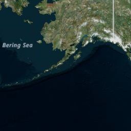
Based on radar over the Pacific from The Weather Channel, a massive storm is headed directly for the U.S. and Canadian West Coast, which broke off from a larger formation (shown below) that was more than 2000 miles wide on March 17, 2011. The formation passed over Japan during its nuclear plant’s meltdown, and may well match predictions that radiation could reach the West Coast.
This screenshot taken at 5:39 PM EDT, March 18, 2011 shows a massive storm in the Pacific Ocean headed directly for the West Coast. Obviously, the radar image loop is continuously updated– check here for most recent activity.
Live Doppler 4:00 pm pacific
Live Doppler 4:00 pm pacific


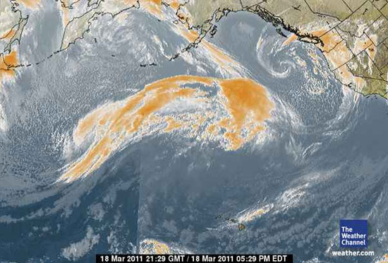
The Weather Channel, Timestamp 18 March 2001 21:29 GMT / 5:29 PM EDT
Click here for live update of Pacific Satellite animation at Intellicast.
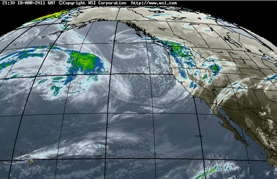
A similar radar image from Intellicast’s Pacific Satellite, Timestamp 21:30 18-MAR-2011
Activist Post featured a video taken yesterday, March 17, 2011, featuring a massive storm some 2000 miles or greater in diameter. That storm has now changed formation, but is still quite large and vectoring towards the West Coast.
March 17, 2011 – MEGA STORM forms in the Pacific
MEANWHILE… Prevailing winds threaten radiation for Tokyo
Zero Hedge
March 18, 2011
March 18, 2011
Absent further deterioration at the Fukushima plant over the weekend, the next big shoe to drop will be public reaction when the radioactive fallout hits Tokyo (and other major populated areas). And juging by the latest data available from Central Institute for Meteorology and Geodynamics (ZAMG) in Austria, Tokyo, which so far has been spared by friendly winds, may get its first dose of radiation by the weekend. Below we present the latest animated color-coded data for both Japan and the world, which extrapolates both fallout strength and direction.
As ZAMG explains the fallout is, “currently in a critical region, dominated by a westerly flow. On the ground, the wind is relatively weak. There is no precipitation. Soon the wind will blow from the south-east and intensify. On Sunday rain front will arrive from the southwest to the crisis area and lead to some strong precipitation (radioactive rain). Behind the front, northerly winds are forecast, so the situation for the Tokyo area may again be critical. The dispersion calculations show fallout is now mainly transported to the sea. Currently cloud have a southeast direction, which will change to northeast tomorrow (see illustrations). Subsequently, more areas in Japan will be covered by fallout.”
Japan fallout tracker:
And more importantly for everyone not in Japan, the global fallout tracker:
And as the forecast, map cuts off mid day on March 20, this is how the wind pattern will look on that day.
http://chaoticfate.blogspot.com
0 comments:
Post a Comment